Accelerated technological development and increasingly significant environmental challenges are the backbone of the modern world, as a result of which innovation becomes the key to success, competitiveness and sustainability in the energy industry. Striving to keep up with modern trends in the innovation segment, the NIS company has started a pilot project of recording oil sites with drones, which simultaneously saves the two most important resources - energy and time.
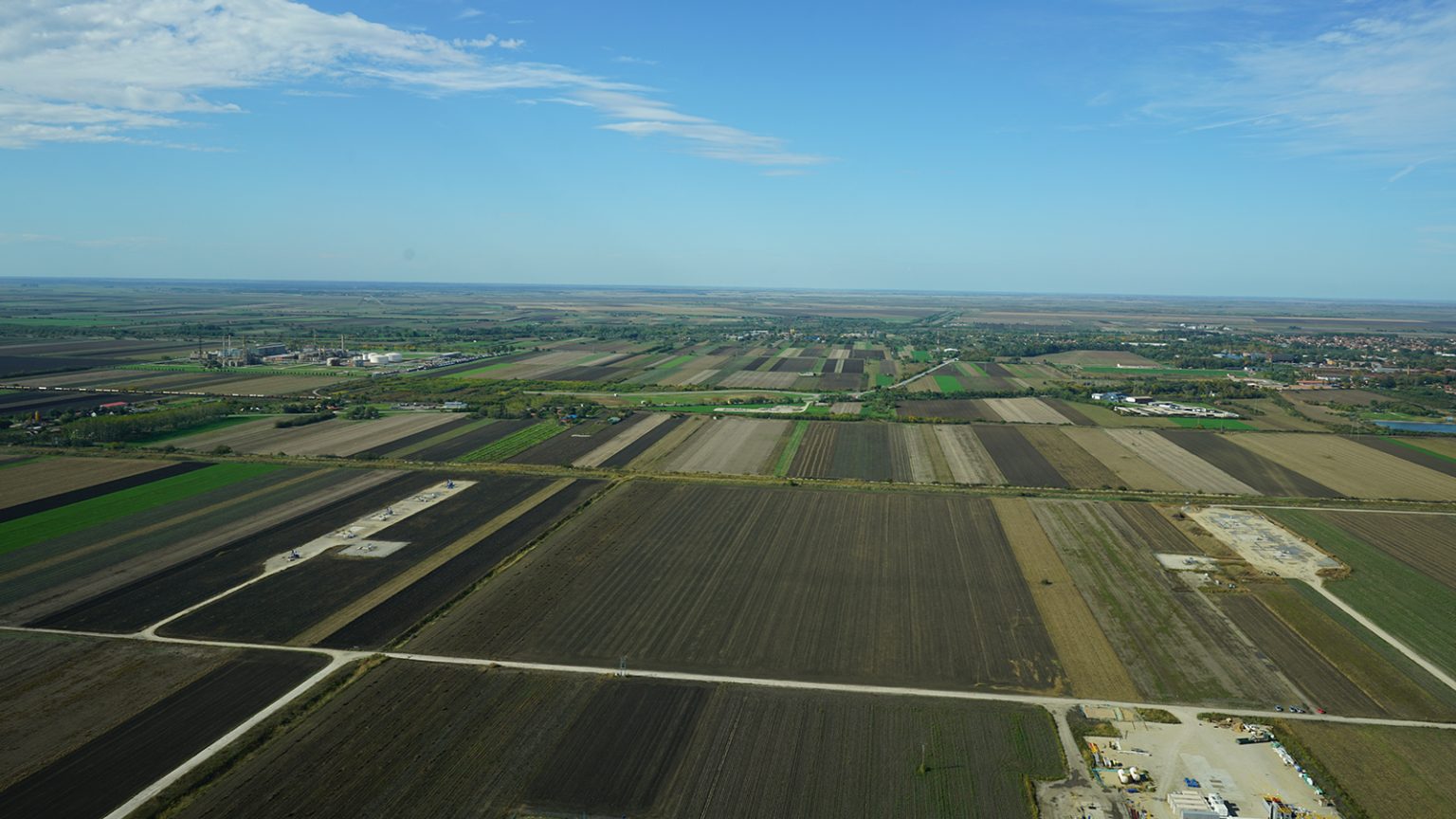
Replacing the traditional methods of geodetic surveying, the aforementioned technology enables fast, safe and precise data collection from the field, and the NIS company used drones for the first time to survey the Kikinda oil field. On that occasion, an area of approximately 1200ha was recorded in 16 days of recording, which is an exceptional saving in the process.
In addition to saving time, recording with drones also ensured a precision of 3 cm per pixel and an accuracy of determining points on the ground of only 15 to 20 mm, and during one day it is possible to record up to 90 hectares of the ground surface. Collected data includes digital terrain models, orthophotos and point clouds, which serve as the basis for geological models and infrastructure design.
An additional advantage, which the use of this technology brings, is the possibility of laser scanning of the soil despite dense vegetation, through advanced drones with LIDAR sensors, as well as the possibility of detecting potential losses of liquid or pressure and leaks in pipelines, which can be detected by drones with thermal cameras. In this way, the mentioned technology can improve the safety of employees, but also reduce potential risks to the environment, which also achieves a significant ecological shift in the field of the energy industry.
The ecological benefits of drone recording are also reflected in the possibilities to reduce CO₂ emissions during the execution of works, because more accurate mapping of the terrain and the availability of recorded material reduce the need to return to the field and perform various technical works.
The field recording was carried out by a team of engineers from the Scientific and Technological Center of the NIS company, whose intention is to extend this practice to other research and production locations of the company. Innovative drones simultaneously improve business standards in the field of planning and execution of projects, but also create a modern working environment for NIS experts from a wide variety of fields:
"In a short period of time, it is possible to capture large areas, and the orthophoto image literally "revives" the location - the designer can view different aspects of the terrain at any time without the need to go out to the field again. So, for example, a 25-hectare site was recorded in one day, which represents a saving of seven days in the project process. Keeping up with modern technologies, such as drone photography, makes our company not only more competitive on the market, but also desirable for new generations of young engineers," said Aleksandar Knežević, director of the NTC Engineering Department.
The use of drones also fits into the broader strategic direction of the NIS company towards digitalization of business. Investments in advanced technologies, such as this, are part of the company's vision, based on efficiency, responsible management and sustainable development. In addition, the mentioned technology represents not only a technical breakthrough for the company, but also an important strategic tool for the long-term improvement of business processes in accordance with global trends and market requirements.